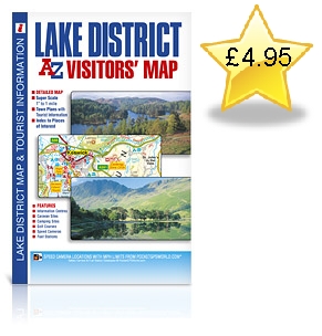
This full colour foldout visitors' map of the Lake District covers an area extending to include:
Workington
Cockermouth
Keswick
Penrith
Shap
Kendal
Milnthorpe
Grange-over-Sands
Ulverston
Millom
Bootle
Ravenglass
Egremont
St. Bees Head
Whitehaven.
The detailed road mapping, which includes contour colouring, highlights the locations of a wide range of visitor attractions and places of interest.
There are town centre street maps of:
Ambleside
Cockermouth
Coniston
Grange-over-Sands
Grasmere
Hawkshead
Kendal
Keswick
Penrith
Ulverston
Windermere and Bowness-on-Windermere
These town centre maps are accompanied by text which gives helpful information about each town and its visitor attractions and places of interest.
There are separate indexes to the towns, villages and hamlets featured on the road mapping and to the selected places of interest featured on the road and street mapping. Fuel station and safety camera locations with their maximum speed limit are featured on both the road and street mapping.